Do global marine heat waves impact southwest monsoon?
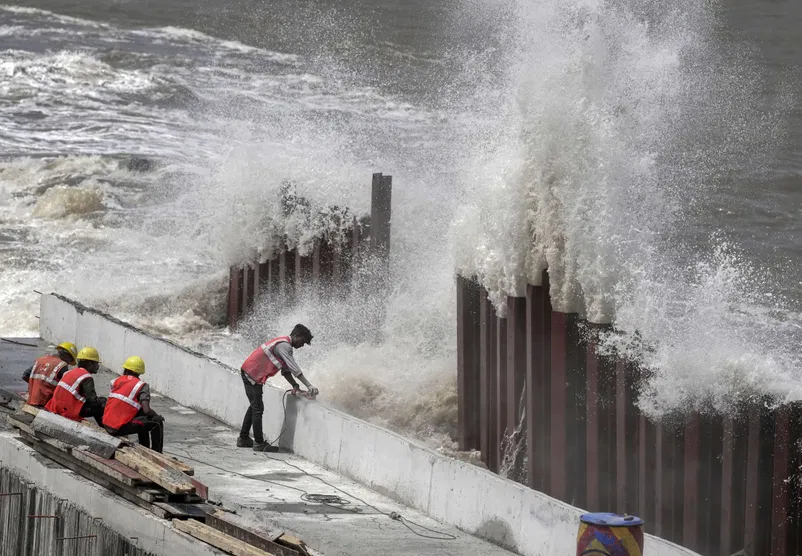
Construction workers at Marine Drive as high tidal waves lash the shore ahead of the landfall of Cyclone Biparjoy in Mumbai on June 15. (Credit: PTI Photo)
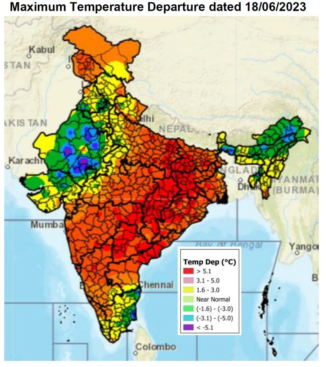
New Delhi: By mid-June, the south-west monsoon has covered half of the country – the entire south India, east India, north-east India, parts of Maharashtra, Chhattisgarh and Madhya Pradesh. And, west and north-west India simmer as the rising mercury coupled with increased humidity make life miserable for humans and animals alike.
In complete contrast with this, India is witnessing some extreme weather events over last three days thanks to a delayed monsoon, aftereffects of Very Severe Cyclonic Storm Biparjoy and rising ocean heat. West and Northwest India have registered excessive rainfall while eastern region has bore the brunt of a massive heat wave leading to death of over 100 persons in eastern Uttar Pradesh and Bihar.
The Centre held an emergency meeting on Tuesday, June 20, in connection with heat wave and heat action plans.
To start with, the onset of monsoon over Kerala was delayed. The monsoon onset happened on June 8. However, the progress of monsoon was slow and with the cyclone looming large, it did not move further.
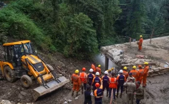
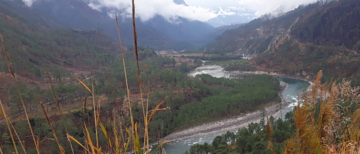
The reason was Biparjoy. Starting in the Arabian Sea, the Very Severe Cyclonic Storm Biparjoy made a landfall near Jakhau port in Gujarat dumping copious quantities of rains coupled with strong winds. The system travelled towards Rajasthan, which too received very heavy to extremely heavy rainfall – some places received more than 200 mm or 300 mm rainfall in a day.
And on the other hand, a massive heat wave spread over Odisha, Chhattisgarh, Telangana, Andhra Pradesh, eastern Uttar Pradesh, Bihar, Jharkhand, parts of West Bengal, eastern Madhya Pradesh and Vidarbha region of Maharashtra.
Picture credit: India Meteorological Department
Global Ocean Heatwave and India’s extreme weather events
During the same time, what some scientists described as a “beyond extreme” marine heat wave has engulfed the world oceans, especially the northern Atlantic.
Professor Jeff Berardelli, Chief Meteorologist and Climate Specialist, BS Atmospheric Sciences, Cornell University, tweeted: “Global oceans are severely hotter than we have ever observed since records began. There are several ocean heat waves.”
He also pointed out how it was a category V marine heatwave in the United Kingdom and that the phenomenon of El Nino “causes dangers for Galapagos marine life” and how boiling tropical Atlantic means “early hurricanes.”
Berardelli also described how since 1970, the Tropical Atlantic has warmed by 1.5-2 degrees Farenheit.
“This warming can be attributed to both greenhouse warming and decreasing aerosols,” he said, adding, “Each 1F increase in sea surface temperatures is equal to a potential intensity increase in strong tropical cyclone of 10 mph.”
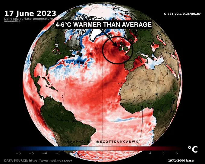
Picture credit: Scott Duncan
That brings up the question: Are India’s current extreme weather events solitary or a part of global chain of events?
Explained climate scientist Prof Raghu Murtugudde from Indian Institute of Technology (IIT) Bombay: “From January itself the north Indian Ocean had been warming and that’s because of the winds being anti-cyclone, which means, they travel clock-wise. This actually built up the heat and then funny things started happening. Because there were couple of typhoons in the Pacific – Mawar and Guchol – which started pulling winds all the way across the Bay of Bengal into the South Pacific. This has delayed the monsoon because the trough which reached Andaman & Nicobar after the Cyclone Mocha, couldn’t go forward.”
“The weakened winds over the Arabian Sea allowed Biparjoy to form and Biparjoy became so strong and lasted well into the monsoon season which is very unusual and it lasted very long time,” Murtugudde said and stated, “It is that heat that had been building up and these unusual winds related to typhoon influence and the cyclones together – even before the cyclone, there were heat waves on the east coast, Odisha, West Bengal – basically they were all related to winds that were clockwise and bringing heat on to these regions.”
Biparjoy sucked away the monsoon winds so that south-westerly winds were not so south-westerly and they were feeding Biparjoy, which in turn, allowed winds to basically pump heat into parts of India and (led to) deficit rainfall.
“So, it’s a complicated local situation but it very much related to the Arabian Sea and Bay of Bengal warming, which is part of the global warming pattern. Its a deadly combination of what happens locally and how the typhoons are now pulling winds and moisture from the Indian Ocean,” he added.
Said Roxy Mathew Koll, scientist with the Indian Institute of Tropical Meteorology (IITM), Pune, “Cyclone Tauktae lived long after landfall and brought rains inland. Prior to that, Cyclone Vayu formed similar to Biparjoy during monsoon onset and interfered with the rains. Chances of cyclone formation are high if the monsoon onset is delayed and the Arabian Sea temperatures are warm.”
The monsoon onset over Andaman & Nicobar this year happened around June 15, little before normal. Extremely Severe Cyclonic Storm Mocha that originated in the north Indian Ocean and travelled towards Myanmar and parts of Bangladesh dissipated on June 15, 2023.
“Mocha pulled up the monsoon trough and left it on Nicobar. Then Mawar and Guchol started to make the winds on Bay of Bengal very different,” Murtugudde described.
The IMD describes monsoon trough as an elongated low-pressure area. Mawar and Guchol were very strong typhoons in Philippines tropical region.
“Last couple of years, we have had cyclones actually pulling monsoon troughs forward and allowing onset to move forward. But this time, it played out very differently because of the typhoons interacting with the Indian Ocean and the trough getting stuck over the Andaman & Nicobar,” the IIT Bombay professor said.
The important question then is whether or not such a phenomenon is unique?
Murtugudde described it as “It is so unique that it’s a combination of things. Whether this combination will happen again, we cannot say with guarantee. North Indian Ocean warming is guaranteed to happen again. Pre-monsoon cyclones are guaranteed to happen again. Whether they will interact with the (monsoon) trough in certain ways and other typhoons will affect the monsoon, those have to be watched carefully.”
Also, would the marine heat waves leave an impact on India’s monsoon? Koll’s January 2022 study has established how marine heatwaves have increased by up to four-fold in the tropical Indian Ocean, aided by rapid warming in the Indian Ocean and strong El Niños.
“Our study showed how these marine heatwaves impact the monsoon by reducing the rainfall over the central Indian subcontinent while enhancing it over the southern peninsula,” Koll told News9 Plus.
Government in action
Meanwhile, on Tuesday, June 20, Union Health Minister Mansukh Mandaviya held a top-level meeting to discuss heat waves in the eastern parts of the country to chalk out a solution plan. On Wednesday, June 21, the Union Health Minister will be holding a meeting via video conferencing with disaster management officials and ministers of eastern states such as Odisha, Chhattisgarh, West Bengal, Telangana, Jharkhand and Bihar where heat wave conditions are prevailing.
This came two days after reports pouring in from eastern Uttar Pradesh and Bihar said that over 100 people had lost live due to the current heatwave since Saturday, June 17.
After the meeting on June 20, Mandaviya told media: “I have also instructed the ICMR to prepare well in advance to prevent heatstroke deaths.”
On a positive note, the IMD has forecast that heat wave conditions over east India & adjoining Central India areas are likely to abate from Wednesday.
“Conditions are favourable for further advance of Southwest Monsoon over some more parts of South Peninsular India, some parts of Odisha, some more parts of Gangetic West Bengal, Jharkhand, Bihar and some parts of East Uttar Pradesh during next 2-3 days,” the IMD forecast on June 20 had said.
(This story first appeared on news9live.com on Jun 21, 2023 and can be read here.)